✦ San Luis Potosí · Mexico
Where is Huasteca Potosina? Region, map and getting there
A region where jungle, turquoise waterfalls and an ancient culture share one of the most extraordinary landscapes in Mexico.
Location
San Luis Potosí, Mexico
Altitude
50 – 2,000 m (164 – 6,562 ft)
Temperature
22 – 34°C average (72 – 93°F)
Best time
October 30 to May
Languages
Spanish · Teenek (Huastec)
Rivers
Tampaón, Axtla, Gallinas, Moctezuma
The short answer
Where it is: state, towns and distances
Huasteca Potosina is in the east of the state of San Luis Potosí, in Mexico: the strip where the Sierra Madre Oriental drops down toward the coastal plain. Its gateway is Ciudad Valles (6.5 to 7 h by car from Mexico City) and its best-known town is Xilitla, up in the mountains, home to the Las Pozas surrealist garden.
Municipalities
Its municipalities include Aquismón, Axtla de Terrazas, Ciudad Valles, Coxcatlán, Ébano, El Naranjo, Huehuetlán, Matlapa, San Martín Chalchicuautla, San Vicente Tancuayalab, Tamasopo, Tamuín, Tancanhuitz, Tanlajás, and Xilitla: the ones with destinations on this site.
Driving times
| From | To Ciudad Valles | To Xilitla |
|---|---|---|
| Mexico City | 6.5 to 7 h | 7 h |
| San Luis Potosí | ~3 h | 5 h |
| Tampico | ~2 h | 3.5 h |
| Monterrey | ~6 h | ~7 h |
By bus: ~8 h from Mexico City to Ciudad Valles and 9 to 10 h to Xilitla; ~8 h from Monterrey to Ciudad Valles.
Where should you stay? We compare both bases with real travel times in Xilitla or Ciudad Valles?
The region, from our door
We leave from Xilitla. Tamul and Las Huahuas sinkhole are to the north, Tamasopo and Puente de Dios to the west, and Las Pozas is a five-minute walk from the hotel.
How long it takes to Xilitla
- Mexico City7 h
- San Luis Potosí5 h
- Tampico3.5 h
Where we go
Geography and nature
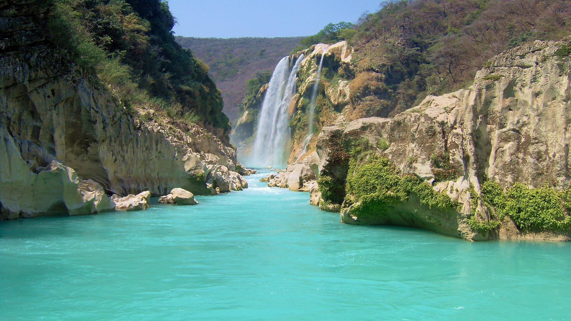
Huasteca Potosina occupies the eastern strip of the state of San Luis Potosí, where the Sierra Madre Oriental drops sharply toward the coastal plain. That change in elevation creates one of the most dramatic landscapes in Mexico: rivers running turquoise over limestone beds, deep canyons carved by millions of years of erosion, and tropical forests that are home to hundreds of endemic species.
The region's karst system produces unique phenomena: vertical sinkholes that cut hundreds of meters into the earth, crystal-clear springs that rise out of the rock, and caves with ancient geological formations. The biodiversity is extraordinary — more than 3,000 plant species and hundreds of bird species recorded in a relatively small area.
History and Teenek culture
The Huasteca has been inhabited for more than 3,000 years. The Teenek culture (also called Huastec) developed one of the most sophisticated civilizations in Mesoamerica here, with monumental architecture you can still see at the Tamtoc archaeological site, considered one of the most important ceremonial centers of pre-Hispanic Mexico.
The Teenek resisted the Spanish conquest longer than many other peoples, and their culture is still alive today: hand-embroidered crafts keep designs that date back centuries before colonization. The local food — zacahuil, bocoles, enchiladas huastecas — is just as old and just as unique.
Food
Huastec cooking is one of the most distinctive in Mexico. Zacahuil is its masterpiece: a giant tamale up to 3 meters (10 ft) long, cooked overnight in an earth pit on Saturdays. Bocoles are thick masa cakes with black beans worked into the dough, cooked on a comal. Enchiladas huastecas come with cecina (salt-dried beef) and fresh local cheese.
The high-altitude coffee grown on the slopes of the Xilitla sierra is exceptional — organic, shade-grown, with notes of chocolate and red berries. The region's artisanal sugarcane spirit (aguardiente) accompanies every community's patron-saint festivals.
Must-see places
Iconic destinations
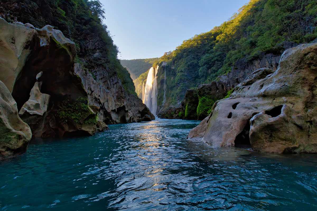
Tamul Waterfall
The tallest waterfall in the region: 344 ft (105 m) over the Tampaón River.
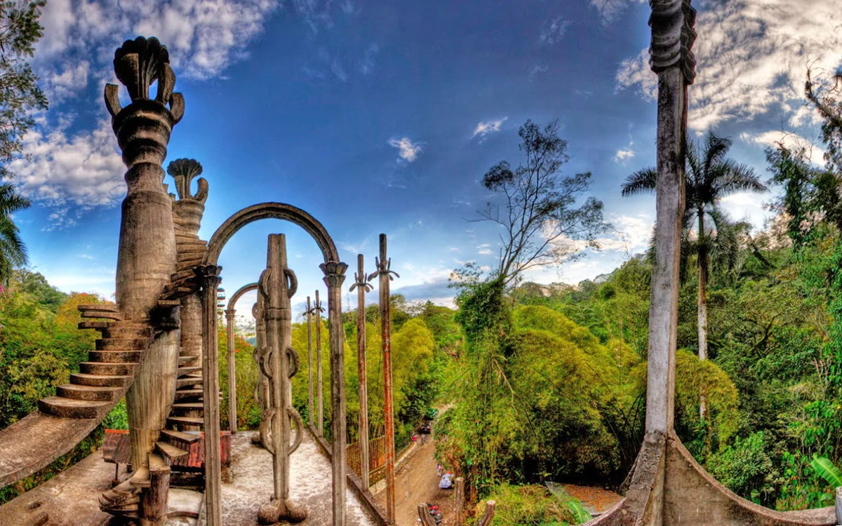
Las Pozas by Edward James
A one-of-a-kind surrealist garden built in the Xilitla jungle.
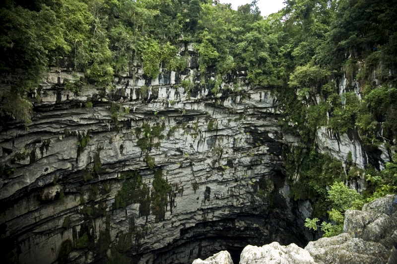
Sótano de las Golondrinas (Cave of Swallows)
One of the largest open-air pit caves in the world, home to thousands of swifts.
Micos Waterfalls
Seven stepped waterfalls in lush tropical jungle.
How to get to Huasteca Potosina?
By air
The most convenient airport is Tampico (TAM), ~2 h by car from Ciudad Valles. You can also fly into the city of San Luis Potosí (~3 h to Valles).
By bus
ADO and Ómnibus de México run from Mexico City, Monterrey and San Luis Potosí. Ciudad Valles is ~8 h from Mexico City.
By car
From Mexico City on Highway 85D: 6.5 to 7 h on the toll road. We recommend arriving in daylight.
Huasteca Potosina: frequently asked questions
Where is Huasteca Potosina?
In the east of the state of San Luis Potosí, in Mexico, where the Sierra Madre Oriental drops down toward the coastal plain. Its gateway is Ciudad Valles and its best-known town is Xilitla, up in the mountains. From Mexico City it's 6.5 to 7 h by car to Ciudad Valles.
What state is Huasteca Potosina in?
San Luis Potosí — that's exactly what "Potosina" means: the part of the Huasteca that lies in that state. Its municipalities include Aquismón, Axtla de Terrazas, Ciudad Valles, Coxcatlán, Ébano, El Naranjo, Huehuetlán, Matlapa, San Martín Chalchicuautla, San Vicente Tancuayalab, Tamasopo, Tamuín, Tancanhuitz, Tanlajás, and Xilitla.
What is the closest airport to Huasteca Potosina?
The most convenient is Tampico (TAM): ~2 h by car to Ciudad Valles and 3.5 h to Xilitla. The other option is flying into the city of San Luis Potosí, ~3 h from Ciudad Valles. From the airport, a rental car or a private transfer works best.
How do I get to Huasteca Potosina from Mexico City?
By car it's 6.5 to 7 h to Ciudad Valles and 7 h to Xilitla. By bus, ~8 h to Ciudad Valles (there are overnight departures from the Terminal del Norte) and 9 to 10 h to Xilitla. And every month there's a small-group trip from Mexico City with transport, hotel, breakfasts, Las Pozas and Tamul included.
Should I stay in Xilitla or Ciudad Valles?
It depends on what you're coming for. Ciudad Valles is closer to Micos, Tamul and Tamasopo and has more hotels; Xilitla is a Pueblo Mágico up in the mountains, with Las Pozas right in town. We compare them with travel times from each base.
Xilitla or Ciudad Valles? Where to stay →When is the best time to visit Huasteca Potosina?
From October 30 to May, when the water runs clear. From March to May the turquoise is at its most intense, but that's also when it's busiest (Holy Week fills up). July to October is the rainy season: the waterfalls are in full flow and the jungle is at its greenest, but the water can run cloudy with sediment.
When to go, season by season →Ready to explore
Start your adventure in the Huasteca
Guided tours with a certified guide; 13 of our 14 tours pick you up at your lodging. Groups of up to 12 people — if there are more of you, talk to the team and we'll set up a private departure.